01
Property & Access
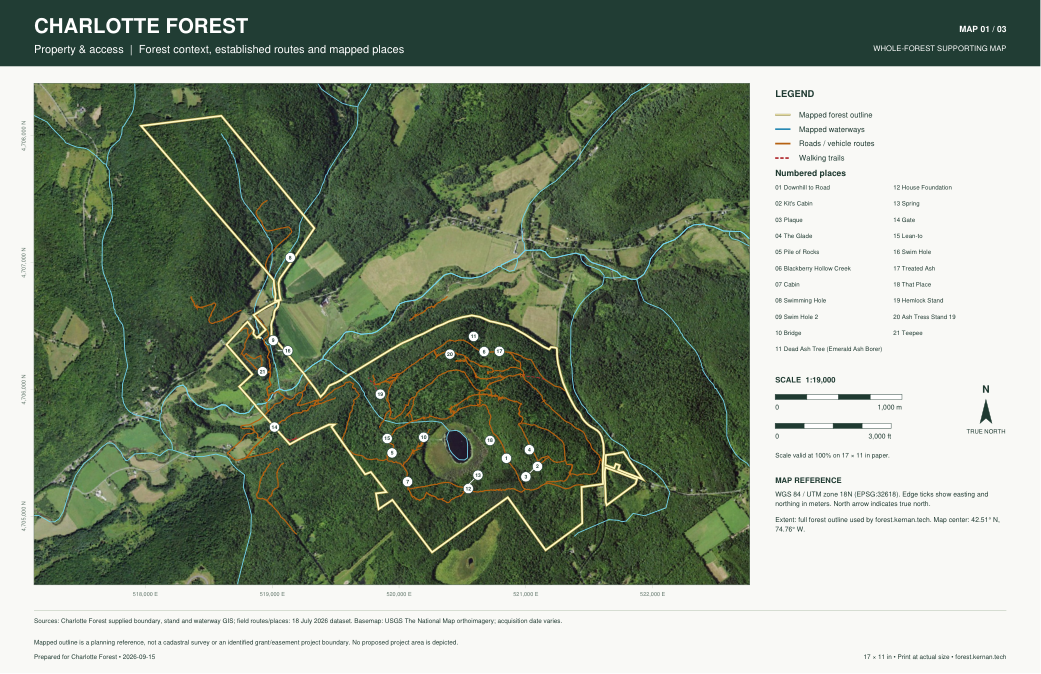
Aerial context, forest outline, established roads, walking trails, mapped places and waterways.
 Enlarge static preview ↗Download Property & Access · PDF
CHARLOTTE FOREST
Whole-forest supporting maps for grant applications. Three fixed views with matching extent and scale, ready to print or attach.
Download all 3 maps · PDFEach PDF includes a legend, north arrow, scale bars, coordinate reference, sources and preparation date. Print on 17 × 11 inch paper at actual size for the stated scale. Scale bars remain useful if the page is resized.
These maps cover the whole mapped forest. They do not designate a grant project, treatment area or conservation easement.
Aerial context, forest outline, established roads, walking trails, mapped places and waterways.
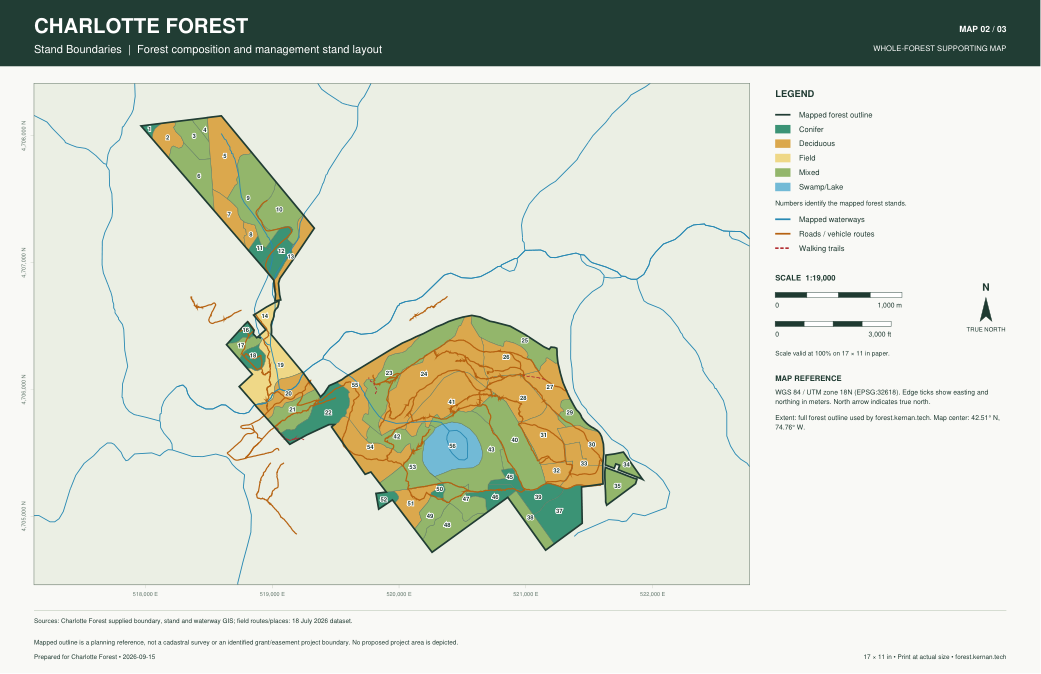
Enlarge static preview ↗Download Property & Access · PDFNumbered stand boundaries colored by forest type, with established routes and waterways for orientation.
 Enlarge static preview ↗Download Stand Boundaries · PDF
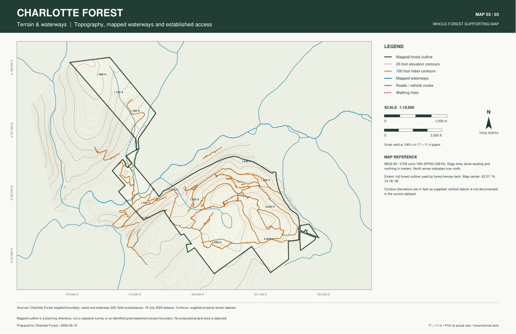
20-foot elevation contours, labeled 100-foot contours, mapped waterways and established access.
 Enlarge static preview ↗Download Terrain & Waterways · PDF